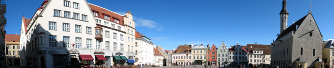
58.828888, 22.776112
GPS: 58° 49' 44" N, 22° 46' 34" E
It was in 1981 that the archaeologists spotted charcoal marks under the church floor –
a stone church was erected in 1492–1515 but it had had an even earlier predecessor
from the 13th century. Everything was going fine but then the stone building too got hit
by a German bomb. This is the moment the church owns its look to.
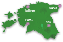
Kassari is the fifth biggest island in Estonia, its area is 19.3 square km. Its coast is washed by the waters of Jausa, Käina, Vaemla, Kassari and Õunaku bays.
Kassari rose from the sea 3000 years ago and the highest point on the isla...
The beam of light from Kõpu spreads from as high as 102.6 meters, that is the maximum height a light house glimmers by
the Baltic Sea. The light house was built in the 15th century, the golden age of Hansa League, maritime trade, demanded i...
Established in 1628 it had 35 workers during its glory days. One of the glass masters
complained to Tallinn that the malice of the local people made him stop working but the
market had been overestimated too and the works was closed down in 1664. ...


)
)
)
)
)

)
)
)